Atlases Charts and Maps
Showing all 5 resultsSorted by latest
-

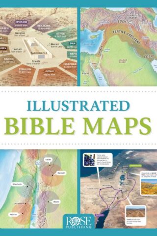
Illustrated Bible Maps
$29.99Packed full of fascinating maps, photos, and diagrams, Illustrated Bible Maps shows when and where Bible events happened. More than 100 Bible maps and illustrations will take you chronologically through the Old and New Testaments–from Abraham’s homeland in Mesopotamia to the seven churches of Revelation in Asia Minor.
*See the mountains of Ararat where Noah’s ark came to rest.
*Follow the route of the exodus through the Sinai Peninsula.
*See where David faced Goliath in the Valley of Elah.
*Locate all the places mentioned in the book of Psalms.
*Trace Paul’s missionary journeys across the Mediterranean Sea.You’ll gain a deeper understanding the ancient world of the Bible, with maps showing the rise and fall of empires like Assyria, Babylon, and Persia. Beautiful photos of the Holy Land will help you see where Jesus walked. Each chapter includes a concise timeline of the biblical time period so you can follow along with the big story of God’s work in the world through his people.
Read moreOut of stock
-
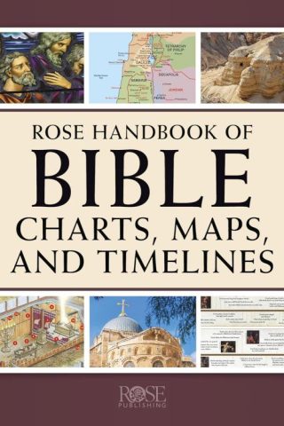
Rose Handbook Of Bible Charts Maps And Timelines
$34.99Over 250 full-color Bible charts and maps. More than 2,000 years of timelines. Hundreds of key people and events. The Rose Handbook of Bible Charts, Maps, and Timelines is a must-have reference guide packed with incredible full-color study tools, illustrations, diagrams, and so much more! Not only will the resources in this handbook make the complex ideas in God’s Word both visual and easy-to-understand, but it will make exploration of the Bible more enjoyable and fascinating than ever!
Bible maps and timelines. Israel’s feasts and family trees. Heaven and history. Proofs and prophecies. And so much more. Whatever Bible topics you’re looking for, you can easily find it with the turn of a page in The Rose Handbook of Bible Charts, Maps, and Timelines. Enjoy having more than 500 pages of full-color Bible maps, charts, timelines, and illustrations, covering dozens of Bible and Christian living topics! Includes:
*Over 250 full-color reference charts featuring the New and Old Testaments, Christian history, genealogies, and more!
*Hundreds of fascinating overviews of beloved Bible teachings (Jesus’ parables, Beatitudes, fruit of the Spirit, the armor of God, etc.)
*Dozens of timelines across 2,000 years of church history
*Then and Now maps of Bible places
*In-depth dives into the twelve tribes, prophecies, Jewish feasts, Dead Sea Scrolls, and the Gospels
*Biblical answers about prayer, heaven, money, forgiveness, sharing the gospel, and following Jesus
*Side-by-side comparisons of major religions, cults, worldviews, and Christian denominations
*Different views on baptism, the Lord’s Supper, spiritual gifts, Revelation, and the end times
Packed full of fascinating details, The Rose Handbook of Bible Charts, Maps, and Timelines is sure to become your go-to resource for study, research, or answering a biblical question when it pops up!
Key Features of The Rose Handbook of Bible Charts, Maps, and Timelines
*Easy-to-Understand Designed with clear headings, bullet points, and written in an approachable style, The Rose Handbook is perfect for lifelong believers, new Christians, and youth groups!
*Illustrated and Highly Visual Don’t just read about Noah’s Ark or where the exodus took place–SEE IT with colorful diagrams, cutaways, maps, and pictures. Enjoy having side-by-side comparisons of the Gospels, prophecies and fulfillments of Jesus, illustrated timelines of Christian history, and so much more!
*Flexible & Multipurpose:
Read moreOut of stock
-
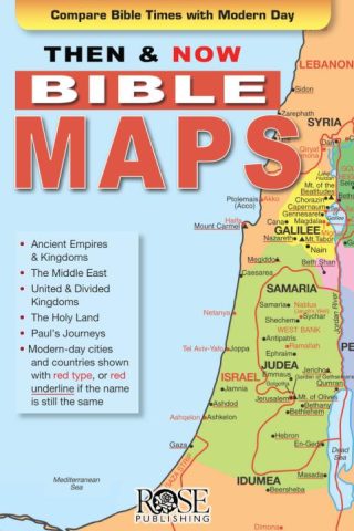
Deluxe Then And Now Bible Maps (Expanded)
$24.99This is the paperback version of the best-selling Deluxe Then and Now Bible Maps! This book lets you see where Bible places are today. Full-color Bible maps are alongside locations of modern-day cities and countries.
Connect the Middle East of the news with the Holy Land in Scripture. Includes maps for favorite Bible stories, like Abraham’s journey to the promised land, the exodus out of Egypt, the story of Ruth, David’s rise from shepherd to king, and Paul’s missionary journeys.
32 maps, including:
*Journeys of Abraham, Jacob, Joseph
*The Exodus
*The 12 Tribes of Israel
*Kingdoms of Saul, David, Solomon
*Holy Land in the Time of Jesus
*Journeys of Paul, Peter, Philip
*Early ChristianityCharts, timelines, and illustrations, including:
*Old and New Testament Timelines
*Tabernacle and Temple
*Exodus Timeline
*Ark of the Covenant
*Where Jesus Walked
*The 12 Disciples
*City of Jerusalem
*Jesus’ Journey to the Cross
*Seven Churches of RevelationAn excellent way to make your Sunday school, homeschool, and Bible studies more interesting. This book uses larger, easier-to-read type than most Bible atlases.
Read moreOut of stock
-
Rose Book Of Bible Charts Maps And Time Lines
$34.99New! All Your Favorite Rose Charts in One Book!
ROSE BOOK OF BIBLE CHARTS, MAPS & TIME LINES
Now you can have 180 pages of full-color Bible charts, maps, and time lines in one spiral bound book. The full-color Rose Book of Bible Charts, Maps, and Time Lines contains–General Bible Charts
* 100 Well-Known People in the Bible
* 100 Well-Known Prayers in the Bible
* Table of Biblical Weights and Measures
* Books of the Bible
* Bible Overview–Old Testament
* Bible Overview–New Testament
* How We Got the Bible
* Christian History Time LineOld Testament Charts
* The Creation
* 100 Well-Known Old Testament Events
* Family Tree of Abraham, Isaac, and Jacob
* Names of God
* Jesus & The Names of God
* The Ten Commandments and You
* Feasts & Holidays of the Bible
* The Cycle Pattern in Judges
* Kings and Prophets
* Kings
* Prophets
* The Statue in the Book of Daniel
* Archaeology & the Bible–Old TestamentNew Testament Charts
* The Genealogy of Jesus Christ
* 100 Prophecies Fulfilled by Jesus
* Events in the Life of Jesus
* Miracles of Jesus
* Parables of Jesus
* The Beatitudes
* The Twelve Disciples
* Evidence for the Resurrection
* Biblical Descriptions of Heaven & Hell
* 100 Well-Known Events from Acts to Revelation
* 1 Corinthians 13
* The Armor of God
* The Fruit of the Spirit
* Acts of the Sinful Nature
* Seven Churches of Revelation
* Four Views of the End-Times
* Archaeology & the Bible–New TestamentMaps
* Middle East: The (BC) and Now
* Middle East: Expansion by Assyrian Rulers
* Middle East: Babylonian and Persian Empires
* Middle East: Fascination Facts and Figures
* Middle East and Central Asia
* The Holy Land: Then and Now
* The Holy Land: The Exodus
* Exodus Time Line
* The Holy Land: United Kingdom
* The Holy Land: Divided Kingdom
* Where Jesus Walked: Then and Now
* Paul’s Journey’s: Then and Now
* Paul’s First Journey
* Paul’s Second and Third Journeys
* Paul’s Journeys and GuideIllustrations and Diagrams
* Noah’s Ark
* The Tabernacle
* The Ark of the Covenant
* Solomon’s Temple
* Herod’s Temple
* Palm Sunday to EasterChristianity, Cults & Religions
* The Trinity
* Denominations Comparison
* Christianity, Cults & Religions
* Islam & ChristianityIndex
If you bought all of these charts and pamphlets separately, you would pay more than $250. Plus you can reproduce up to 300 copies of any chart free of charge (use in one church, not for sale
Read moreOut of stock
-
Then And Now Bible Maps Pamphlet
$4.99Where are Bible Lands today? This handy quick reference fold-out shows you! It contains more than a dozen Bible maps that include the modern-day boundaries in red. Fantastic for comparing places in the news with places in the Bible.
Includes the following maps:
*The Middle East during Old Testament Times
*The Assyrian Empire, Babylonian Kingdoms and Persian Empire
*The Holy Land during the time of the Old Testament
*United Kingdom, Divided Kingdom compared with modern-day Israel and surrounding countries
*The Holy Land during the time of JesusAll of Paul’s Journeys (Roman Empire at AD 60)
Fits in the back of most Bibles. Size: 8.5″ x 5.5″ Unfolds 38 inches.
Read moreOut of stock